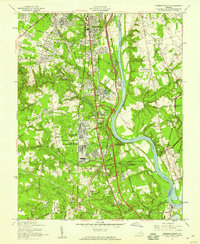
1952 Map of Drewrys Bluff
USGS Topo · Published 1959About this map
The James River corridor south of Richmond reveals a landscape heavily shaped by military and transportation infrastructure in the early 1950s. The massive U S Military Reservation (Richmond Quatermaster Depot) dominates the central terrain near Drewrys Bluff, while the newly added Richmond-Petersburg Turnpike cuts through the area, signaling the post-war shift toward interstate commerce. Civil War history remains visible on the landscape through numerous preserved defensive works within the Richmond National Battlefield Park, including Fort Beauregard and White Battery. Local life is anchored by community landmarks such as the Warwick Road Mission, Hickory Hill Sch, and the Summer Hill neighborhood. The presence of the Richmond Marine Terminal and the Parnell Airport highlights a diversifying regional economy that balanced heavy river traffic with emerging air and highway transit.
Find a feature on this map
77 named features on this map. Tap any name to fly to it.
Don’t see what you’re looking for? This feature index may not catch every label — zoom into the map to look around manually.
Map Details
Editions of this 1952 Drewrys Bluff Map
This is the sole edition of this map. No revisions or reprints were ever made.
Other maps of this area

1890 · Goochland
USGS Topo · 1:125,000

1892 · Goochland
USGS Topo · 1:125,000

1894 · Bermuda Hundred
USGS Topo · 1:62,500

1894 · Richmond
USGS Topo · 1:62,500

1895 · Richmond
USGS Topo · 1:62,500

1897 · Amelia
USGS Topo · 1:125,000

1934 · Seven Pines
USGS Topo · 1:24,000

1934 · Richmond
USGS Topo · 1:24,000

1936 · Richmond West
USGS Topo · 1:24,000

1938 · Dutch Gap
USGS Topo · 1:24,000