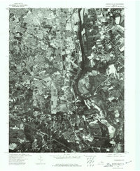
1974 Map of Drewrys Bluff
USGS Topo · Published 1977About this map
The James River carves a deep, winding path through this 1974 orthophotoquad, serving as the dominant landscape feature of the Drewrys Bluff area. The aerial photography reveals the dense industrial and residential expansion stretching south from Richmond, contrasting the structured grid of urban development with the natural contours of the river valley. This specific format—a photographic base overlaid with a topographic grid—provides a rare view of the land as it actually appeared in the mid-1970s, before decades of modern suburban infill. From the clearing at Drewrys Bluff to the heavy infrastructure along the riverbanks, the map documents a region in the midst of significant post-war growth.
Find a feature on this map
3 named features on this map. Tap any name to fly to it.
Don’t see what you’re looking for? This feature index may not catch every label — zoom into the map to look around manually.
Map Details
Editions of this 1974 Drewrys Bluff Map
This is the sole edition of this map. No revisions or reprints were ever made.
Other maps of this area

1890 · Goochland
USGS Topo · 1:125,000

1892 · Goochland
USGS Topo · 1:125,000

1894 · Bermuda Hundred
USGS Topo · 1:62,500

1894 · Richmond
USGS Topo · 1:62,500

1895 · Richmond
USGS Topo · 1:62,500

1897 · Amelia
USGS Topo · 1:125,000

1934 · Seven Pines
USGS Topo · 1:24,000

1934 · Richmond
USGS Topo · 1:24,000

1936 · Richmond West
USGS Topo · 1:24,000

1938 · Dutch Gap
USGS Topo · 1:24,000