
1945 Map of Driftwood
USGS Topo · Published 1953About this map
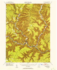
The confluence of Driftwood Branch Sinnemahoning Creek and Bennett Branch Sinnemahoning Creek at the town of Driftwood defines this landscape in the mid-1940s. The map illustrates a rugged river-valley economy where the Pennsylvania and Baltimore and Ohio railroads follow the narrow corridors created by winding waterways. Small river settlements such as Sterling Run, Huntley, and Sinnemahoning are clustered near these rail lines, reflecting the importance of transportation in the deep valleys of the Allegheny Plateau.
Find a feature on this map
108 named features on this map. Tap any name to fly to it.
Don’t see what you’re looking for? This feature index may not catch every label — zoom into the map to look around manually.
Map Details
Editions of this 1945 Driftwood Map
4 editions found
Other maps of this area

1928 · Snow Shoe
USGS Topo · 1:48,000

1929 · Karthaus
USGS Topo · 1:62,500

1929 · Clearfield
USGS Topo · 1:48,000

1931 · Show Shoe
USGS Topo · 1:62,500

1932 · Clearfield
USGS Topo · 1:62,500

1932 · Karthaus
USGS Topo · 1:62,500

1941 · Benezette
USGS Topo · 1:62,500

1943 · Benezette
USGS Topo · 1:62,500

1945 · First Fork
USGS Topo · 1:24,000

1945 · Sinnemahoning
USGS Topo · 1:24,000
Featured Places
- Benezette Township, PA
- Wharton Township, PA
- Driftwood, PA
- Lushbaugh, Grove Township
- Cameron, Lumber Township