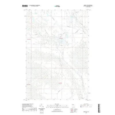
2019 Map of Driggs Lake
USGS Topo · Published 2019About this map
The Driggs River and its intricate tributaries dominate this section of Schoolcraft County, Michigan, defining a landscape of wetlands and water bodies. This area, largely comprised of the expansive Driggs Marsh and Creighton Marsh, is cross-cut by a network of specialized routes like the Walsh Grade and the Fox River Pathway, which suggest a history of resource extraction and backcountry access. Numerous small lakes, including Driggs Lake, Bonnet Lake, and Mahoney Lake, are scattered throughout the northern sections, connected by a web of local roads such as Mahoney Lake Rd and Black Creek Rd. The presence of labels like Driggs Lake Truck Trl indicates a geography managed for forestry and conservation, where the movement of water through Negro Cr and the Little Fox Rivr remains the primary natural feature of the terrain.
Find a feature on this map
33 named features on this map. Tap any name to fly to it.
Don’t see what you’re looking for? This feature index may not catch every label — zoom into the map to look around manually.
Map Details
Editions of this 2019 Driggs Lake Map
This is the sole edition of this map. No revisions or reprints were ever made.
Other maps of this area

1931 · Driggs Lake NE
USGS Topo · 1:31,680

1931 · Shingleton NE
USGS Topo · 1:31,680

1931 · Driggs Lake NW
USGS Topo · 1:31,680

1931 · Shingleton SE
USGS Topo · 1:31,680

1931 · Driggs Lake SW
USGS Topo · 1:31,680

1931 · Driggs Lake SE
USGS Topo · 1:31,680

1958 · Shingleton
USGS Topo · 1:62,500

1958 · Grand Portal Point
USGS Topo · 1:62,500

1958 · Marquette
USGS Topo · 1:250,000

1960 · Marquette
USGS Topo · 1:250,000