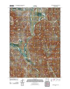
2011 Map of Drinkwater Pass
USGS Topo · Published 2011About this map
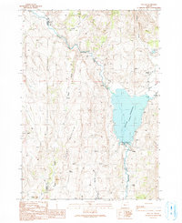
The Malheur River flows through the ranching country of eastern Oregon, carving the broad Drewsey Valley near the small community of Drewsey. This 2011 survey documents a landscape defined by the management of water for livestock and agriculture, featuring numerous irrigation structures such as the Drewsey Reclamation Company Ditch, Stallard Ditch, and Williams Ditch. The settlement of Drewsey remains the local hub, complete with the Drewsey Post Office and a network of county roads leading to isolated properties like Stallard Ranch and Altnow Ranch.
Find a feature on this map
30 named features on this map. Tap any name to fly to it.
Don’t see what you’re looking for? This feature index may not catch every label — zoom into the map to look around manually.
Map Details
Editions of this 2011 Drinkwater Pass Map
This is the sole edition of this map. No revisions or reprints were ever made.
Other maps of this area

1955 · Burns
USGS Topo · 1:250,000

1958 · Burns
USGS Topo · 1:250,000

1959 · Burns
USGS Topo · 1:250,000

1966 · Beulah
USGS Topo · 1:62,500

1968 · Drewsey
USGS Topo · 1:62,500
1973 · Upton Mountain
USGS Topo · 1:24,000
1977 · Bartlett Mtn
USGS Topo · 1:24,000
1978 · Selle Gap
USGS Topo · 1:24,000

1978 · Stinkingwater Mountains
USGS Topo · 1:100,000
1990 · Beulah
USGS Topo · 1:24,000