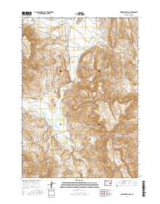
2017 Map of Drinkwater Pass
USGS Topo · Published 2017About this map
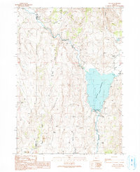
Otis Valley and Drewsey Valley anchor this portion of the High Desert, where the Malheur River and its tributaries carve through the arid terrain of Harney County. The map reveals an intricate network of water management infrastructure essential to the region's ranching history, including the Stallard Ditch, Williams Ditch, and the extensive Drewsey Reclamation Company Ditch. These man-made channels, alongside the Altnow Reservoir and Riley Reservoir, illustrate the significant effort to redirect water across the sagebrush-covered plains. Rising above the valley floors, Drinkwater Pass serves as a key transit point, while the Beede Desert stretches across the northeast. Local springs such as Cook Spring and Weatherly Spring represent critical water sources that once sustained both livestock and early travelers navigating the remote corridors like the Juntura Cutoff Rd.
Find a feature on this map
35 named features on this map. Tap any name to fly to it.
Don’t see what you’re looking for? This feature index may not catch every label — zoom into the map to look around manually.
Map Details
Editions of this 2017 Drinkwater Pass Map
This is the sole edition of this map. No revisions or reprints were ever made.
Other maps of this area

1955 · Burns
USGS Topo · 1:250,000

1958 · Burns
USGS Topo · 1:250,000

1959 · Burns
USGS Topo · 1:250,000

1966 · Beulah
USGS Topo · 1:62,500

1968 · Drewsey
USGS Topo · 1:62,500
1973 · Upton Mountain
USGS Topo · 1:24,000
1977 · Bartlett Mtn
USGS Topo · 1:24,000
1978 · Selle Gap
USGS Topo · 1:24,000

1978 · Stinkingwater Mountains
USGS Topo · 1:100,000
1990 · Beulah
USGS Topo · 1:24,000