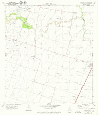
1978 Map of Driscoll West
USGS Topo · Published 1979About this map
The Agua Dulce Stratton Oil and Gas Field dominates this South Texas landscape, defined by an intricate network of pipelines and pumping stations during the late 1970s. The terrain is marked by the industrial footprints of the Harlan Tank Farm and several Pumping Stations, reflecting the region's intensive energy production. Settlement is concentrated along the Missouri Pacific railroad line, where the town of Driscoll serves as a local hub.
Find a feature on this map
22 named features on this map. Tap any name to fly to it.
Don’t see what you’re looking for? This feature index may not catch every label — zoom into the map to look around manually.
Map Details
Editions of this 1978 Driscoll West Map
This is the sole edition of this map. No revisions or reprints were ever made.
Other maps of this area

1924 · Petronilla
USGS Topo · 1:62,500

1925 · Robstown
USGS Topo · 1:62,500

1950 · Corpus Christi
USGS Topo · 1:250,000

1954 · Orange Grove
USGS Topo · 1:62,500

1954 · Robstown
USGS Topo · 1:62,500

1954 · Kingsville
USGS Topo · 1:62,500

1954 · Petronila
USGS Topo · 1:62,500

1956 · Corpus Christi
USGS Topo · 1:250,000

1960 · Corpus Christi
USGS Topo · 1:250,000

1966 · Corpus Christi
USGS Topo · 1:250,000