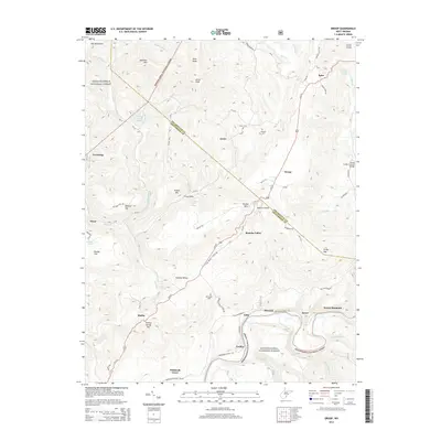
2014 Map of Droop
USGS Topo · Published 2014About this map
Droop Mountain and the winding Greenbrier River define this rural landscape on the border of Pocahontas and Greenbrier Counties. The terrain is characterized by the high elevations of the Yew Mountains and the Monongahela National Forest, where steep ridges like Kennison Mtn give way to the small valley settlements of Renicks Valley and Droop. Historic rural infrastructure is visible in the presence of the Locust Creek Covered Bridge and several family or community burial grounds, including Sunset Cem and Kellison Cem.
Find a feature on this map
83 named features on this map. Tap any name to fly to it.
Don’t see what you’re looking for? This feature index may not catch every label — zoom into the map to look around manually.
Map Details
Editions of this 2014 Droop Map
This is the sole edition of this map. No revisions or reprints were ever made.
Other maps of this area

1887 · Lewisburg
USGS Topo · 1:125,000

1891 · Lewisburg
USGS Topo · 1:125,000

1891 · Huntersville
USGS Topo · 1:125,000

1894 · Huntersville
USGS Topo · 1:125,000

1921 · Callaghan
USGS Topo · 1:48,000

1921 · White Sulphur Springs
USGS Topo · 1:48,000

1923 · Lobelia
USGS Topo · 1:48,000

1923 · White Sulphur Springs
USGS Topo · 1:62,500

1923 · Marlinton
USGS Topo · 1:48,000

1923 · Callaghan
USGS Topo · 1:62,500