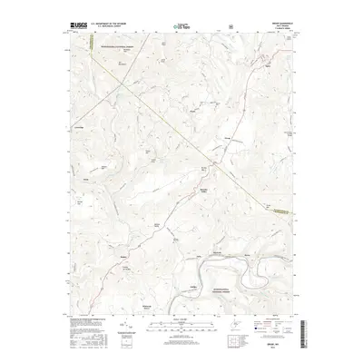
2016 Map of Droop
USGS Topo · Published 2016About this map
The Monongahela National Forest dominates this landscape, where the rugged topography of the Yew Mountains and Kennison Mtn meets the deep karst features of the Friars Hole area. This 2016 survey documents the rural communities of Renicks Valley, Droop, and Modoc along the US Rte 219 corridor. The map highlights the intersection of natural history and local genealogy, specifically through several high-elevation cemeteries such as Kellison Cem and Mountain Gate Cem. In the southern portion of the sheet, the Greenbrier River carves a significant valley, accompanied by the Greenbrier River Rail-Trail, a repurposing of the former rail corridor that reflects the region's shift from industrial extraction to conservation and recreation. Notable springs like Clifford Brown Spring and Vesper Lewis Spring indicate the complex hydrology typical of this portion of the Allegheny Mountains.
Find a feature on this map
85 named features on this map. Tap any name to fly to it.
Don’t see what you’re looking for? This feature index may not catch every label — zoom into the map to look around manually.
Map Details
Editions of this 2016 Droop Map
This is the sole edition of this map. No revisions or reprints were ever made.
Other maps of this area

1887 · Lewisburg
USGS Topo · 1:125,000

1891 · Lewisburg
USGS Topo · 1:125,000

1891 · Huntersville
USGS Topo · 1:125,000

1894 · Huntersville
USGS Topo · 1:125,000

1921 · Callaghan
USGS Topo · 1:48,000

1921 · White Sulphur Springs
USGS Topo · 1:48,000

1923 · Lobelia
USGS Topo · 1:48,000

1923 · White Sulphur Springs
USGS Topo · 1:62,500

1923 · Marlinton
USGS Topo · 1:48,000

1923 · Callaghan
USGS Topo · 1:62,500