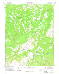
1977 Map of Droop
USGS Topo · Published 1978About this map
Droop Mountain Battlefield State Park sits atop the high plateau where the Pocahontas and Greenbrier county lines meet, marking a landscape defined by significant historical memory and topographic transition. This late-1970s survey captures the area's complex geography, from the heights of Kennison Mountain and Ballard Mountain to the meandering course of the Greenbrier River in the southeast. A network of small rural settlements and religious centers such as Beulah Ch, Hills Chapel, and Mt Olive Ch are scattered across the Little Levels and Renicks Valley, reflecting a long-established mountain community structure.
Find a feature on this map
58 named features on this map. Tap any name to fly to it.
Don’t see what you’re looking for? This feature index may not catch every label — zoom into the map to look around manually.
Map Details
Editions of this 1977 Droop Map
This is the sole edition of this map. No revisions or reprints were ever made.
Other maps of this area

1887 · Lewisburg
USGS Topo · 1:125,000

1891 · Lewisburg
USGS Topo · 1:125,000

1891 · Huntersville
USGS Topo · 1:125,000

1894 · Huntersville
USGS Topo · 1:125,000

1921 · Callaghan
USGS Topo · 1:48,000

1921 · White Sulphur Springs
USGS Topo · 1:48,000

1923 · Lobelia
USGS Topo · 1:48,000

1923 · White Sulphur Springs
USGS Topo · 1:62,500

1923 · Marlinton
USGS Topo · 1:48,000

1923 · Callaghan
USGS Topo · 1:62,500