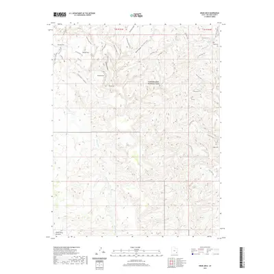
2020 Map of Druid Arch
USGS Topo · Published 2020About this map
Canyonlands National Park dominates this San Juan County landscape, showcasing a complex network of canyons and high-desert formations within the Needles district. The intricate drainage systems of Butler Wash and the West Fork Salt Creek have carved out a topography defined by significant landmarks like the namesake Druid Arch and the secluded Angel Arch. These natural features, along with Kissing Cows and the Devils Kitchen, are connected by a historical web of backcountry routes, including the Joint Trail and Chesler Park Trail. The map illustrates a high degree of isolation, with no modern towns or settlements present, only the expansive basins of Middle Park and Beef Basin at the southern edge. Researchers can trace the pathways of the Salt Creek Trail as it follows the creek bed, passing Peekaboo Spring and several other natural arches that define this geological corridor.
Find a feature on this map
35 named features on this map. Tap any name to fly to it.
Don’t see what you’re looking for? This feature index may not catch every label — zoom into the map to look around manually.
Map Details
Editions of this 2020 Druid Arch Map
This is the sole edition of this map. No revisions or reprints were ever made.
Other maps of this area

1885 · La Sal
USGS Topo · 1:250,000

1886 · Abajo
USGS Topo · 1:250,000

1892 · Abajo
USGS Topo · 1:250,000

1893 · Abajo
USGS Topo · 1:250,000

1935 · Elk Ridge
USGS Topo · 1:96,000

1940 · Elk Ridge
USGS Topo · 1:125,000

1953 · Carlisle 3 NW
USGS Topo · 1:24,000

1953 · The Needles
USGS Topo · 1:62,500

1954 · Elk Ridge 1 NW
USGS Topo · 1:24,000

1954 · Carlisle 4 SW
USGS Topo · 1:24,000