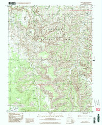
1997 Map of Druid Arch
USGS Topo · Published 2002About this map
Canyonlands National Park dominates this landscape, recorded as it appeared during the late 20th century. The intricate labyrinth of The Needles reveals a geological maze defined by massive erosion, where the famous Druid Arch and Angel Arch stand as prominent landmarks. This survey traces the essential water sources that carved the territory, from the northern reaches of Elephant Canyon and Big Spring Canyon to the southern drainage of Salt Creek and Butler Wash. In the southwest, the terrain transitions into the broad expanse of Beef Basin and Middle Park, areas that suggest historical grazing and exploration beyond the core rock formations. The network of 4wd routes provides the primary means of traversal through this complex geography, linking isolated spots like Peekaboo Spring and the hidden meadows of Chesler Park and Virginia Park. This map is a primary resource for understanding the preservation and primitive access patterns of this remote San Juan County corner.
Find a feature on this map
19 named features on this map. Tap any name to fly to it.
Don’t see what you’re looking for? This feature index may not catch every label — zoom into the map to look around manually.
Map Details
Editions of this 1997 Druid Arch Map
This is the sole edition of this map. No revisions or reprints were ever made.
Other maps of this area

1885 · La Sal
USGS Topo · 1:250,000

1886 · Abajo
USGS Topo · 1:250,000

1892 · Abajo
USGS Topo · 1:250,000

1893 · Abajo
USGS Topo · 1:250,000

1935 · Elk Ridge
USGS Topo · 1:96,000

1940 · Elk Ridge
USGS Topo · 1:125,000

1953 · Carlisle 3 NW
USGS Topo · 1:24,000

1953 · The Needles
USGS Topo · 1:62,500

1954 · Elk Ridge 1 NW
USGS Topo · 1:24,000

1954 · Carlisle 4 SW
USGS Topo · 1:24,000