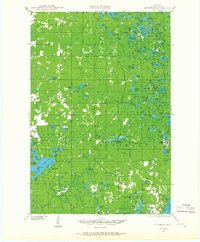
1944 Map of Drummond
USGS Topo · Published 1966About this map
Drummond and the surrounding timberlands of Cheuquamegon define this mid-century survey of Bayfield County. The landscape is a dense network of glacial lakes and small rural institutions, including several country schools like Hall Sch and Maple Grove Sch. The presence of the Delta CCC Camp (Abandoned) near the White River and Lake Delta serves as a record of Depression-era land management and conservation efforts in the Wisconsin Northwoods.
Find a feature on this map
129 named features on this map. Tap any name to fly to it.
Don’t see what you’re looking for? This feature index may not catch every label — zoom into the map to look around manually.
Map Details
Editions of this 1944 Drummond Map
2 editions found
Other maps of this area

1943 · Iron Lake
USGS Topo · 1:48,000

1943 · Namekagon Lake
USGS Topo · 1:48,000

1944 · Moquah
USGS Topo · 1:48,000

1944 · Drummond
USGS Topo · 1:48,000

1944 · Grandview
USGS Topo · 1:48,000

1944 · Hayward
USGS Topo · 1:48,000

1945 · Namekagon Lake
USGS Topo · 1:48,000

1945 · Highland
USGS Topo · 1:48,000

1947 · Drummond
USGS Topo · 1:48,000

1947 · Moquah
USGS Topo · 1:48,000