
1947 Map of Drummond
USGS Topo · Published 1947About this map
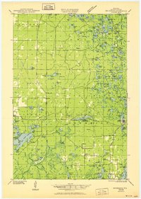
Drummond anchors the southeastern corner of this Bayfield County landscape, appearing shortly after the second World War as a center for the surrounding timberlands and lake districts. The map documents a transition in land use, where former federal work sites like the Delta CCC Camp (Abandoned) and recreational landmarks like the Old Chippewa Camp Ground sit amidst an expansive network of glacial kettle lakes. Small rural schoolhouses, including Hall Sch, Pease Sch, and Maple Grove Sch, are scattered across the townships of Hughes, Delta, and Barnes, providing vital geographic markers for genealogists tracing family locations in this northern Wisconsin region. The map reveals a dense constellation of named water bodies such as Lake Delta, Ruth Lake, and Lake Bullhead, many of which supported early camps and seasonal settlements during the mid-twentieth century.
Find a feature on this map
125 named features on this map. Tap any name to fly to it.
Don’t see what you’re looking for? This feature index may not catch every label — zoom into the map to look around manually.
Map Details
Editions of this 1947 Drummond Map
2 editions found
Other maps of this area

1943 · Iron Lake
USGS Topo · 1:48,000

1943 · Namekagon Lake
USGS Topo · 1:48,000

1944 · Moquah
USGS Topo · 1:48,000

1944 · Drummond
USGS Topo · 1:48,000

1944 · Grandview
USGS Topo · 1:48,000

1944 · Hayward
USGS Topo · 1:48,000

1945 · Namekagon Lake
USGS Topo · 1:48,000

1945 · Highland
USGS Topo · 1:48,000

1947 · Moquah
USGS Topo · 1:48,000

1947 · Brule
USGS Topo · 1:48,000