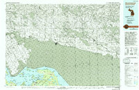
1984 Map of Drummond
USGS Topo · Published 1993About this map
Drummond Island and St Joseph Island dominate this international border survey, illustrating the complex archipelago where the St Marys River meets North Channel (Lake Huron). The map details a transition from the industrial activity at the Quarry near Drummond to the preserved wilderness of the Lake Superior State Forest. The proximity of the United States and Canada is clearly defined through the Chippewa Channel and Mississagi Bay, highlighting a shared maritime landscape defined by narrow straits like De Tour Passage. Small settlements such as Maxton and De Tour Village serve as anchors for the rural road networks on the Michigan side, while the Thessalon River and Mississagi River flow into the channel from the Ontario mainland. This cartography captures the region's mid-century character, balancing active aviation at Drummond Island Airport with the secluded inlets of Potagannissing Bay.
Find a feature on this map
26 named features on this map. Tap any name to fly to it.
Don’t see what you’re looking for? This feature index may not catch every label — zoom into the map to look around manually.
Map Details
Editions of this 1984 Drummond Map
2 editions found
Other maps of this area

1919 · Neebish
USGS Topo · 1:62,500

1941 · Neebish
USGS Topo · 1:63,360

1951 · Lake George
USGS Topo · 1:62,500

1953 · Munuscong NE
USGS Topo · 1:24,000

1954 · Alpena
USGS Topo · 1:250,000

1954 · Sault Sainte Marie
USGS Topo · 1:250,000

1955 · Cheboygan
USGS Topo · 1:250,000

1956 · Sault Sainte Marie
USGS Topo · 1:250,000

1957 · Alpena
USGS Topo · 1:250,000

1957 · Sault Sainte Marie
USGS Topo · 1:250,000