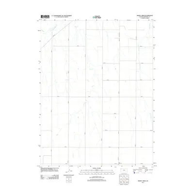
2012 Map of Drury Creek
USGS Topo · Published 2012About this map
The S Fork Republican River cuts across the northwest corner of this Cheyenne County landscape, where the high plains of western Kansas are defined by a rhythmic grid of rural corridors. The map details a transition from the river bottom near River Rd to the uplands drained by Drury Cr and the W Fork Sand Cr. The geometry of the county road system, labeled sequentially from Road 11 through Road 16, underscores the agricultural organization of the territory. Located in the southern section of the quadrangle, the Lawn Ridge Cem stands as a primary genealogical landmark for local families, situated along Road E and Road 15. This 2012 survey illustrates the persistent rural character of the region, where water courses and cemeteries remain the most prominent features in an area otherwise dedicated to section-line farming and open range.
Find a feature on this map
19 named features on this map. Tap any name to fly to it.
Don’t see what you’re looking for? This feature index may not catch every label — zoom into the map to look around manually.
Map Details
Editions of this 2012 Drury Creek Map
This is the sole edition of this map. No revisions or reprints were ever made.
Other maps of this area

1942 · St. Francis
USGS Topo · 1:62,500

1943 · St. Francis
USGS Topo · 1:62,500

1951 · St Francis
USGS Topo · 1:62,500

1951 · Bird City North
USGS Topo · 1:62,500

1951 · Bird City South
USGS Topo · 1:62,500

1952 · St Francis 3
USGS Topo · 1:62,500

1954 · Goodland
USGS Topo · 1:250,000

1956 · Goodland
USGS Topo · 1:250,000

1957 · Goodland
USGS Topo · 1:250,000
1978 · St Francis
USGS Topo · 1:24,000