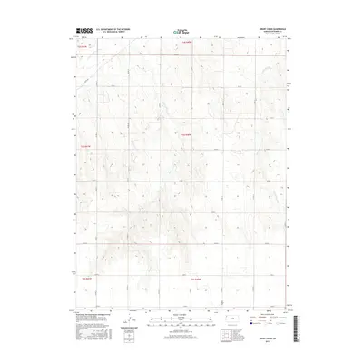
2015 Map of Drury Creek
USGS Topo · Published 2015About this map
The S Fork Republican River cuts through the northwest corner of this Cheyenne County landscape, defining a terrain shaped by the intermittent drainage of the High Plains. Central to the map is the winding course of Drury Cr, which flows northward across several townships including t4s r40w. The area is characterized by a precise grid of rural routes, from River Rd to an extensive network of numbered county roads that facilitate access across the open agricultural sections. In the southern portion of the quadrangle, Lawn Ridge Cem stands as a significant point of interest for genealogists and local historians, situated near the intersection of Co Rd 15 and Co Rd E. To the east, the W Fork Sand Cr further illustrates the complex watershed patterns typical of this portion of western Kansas.
Find a feature on this map
27 named features on this map. Tap any name to fly to it.
Don’t see what you’re looking for? This feature index may not catch every label — zoom into the map to look around manually.
Map Details
Editions of this 2015 Drury Creek Map
This is the sole edition of this map. No revisions or reprints were ever made.
Other maps of this area

1942 · St. Francis
USGS Topo · 1:62,500

1943 · St. Francis
USGS Topo · 1:62,500

1951 · St Francis
USGS Topo · 1:62,500

1951 · Bird City North
USGS Topo · 1:62,500

1951 · Bird City South
USGS Topo · 1:62,500

1952 · St Francis 3
USGS Topo · 1:62,500

1954 · Goodland
USGS Topo · 1:250,000

1956 · Goodland
USGS Topo · 1:250,000

1957 · Goodland
USGS Topo · 1:250,000
1978 · St Francis
USGS Topo · 1:24,000