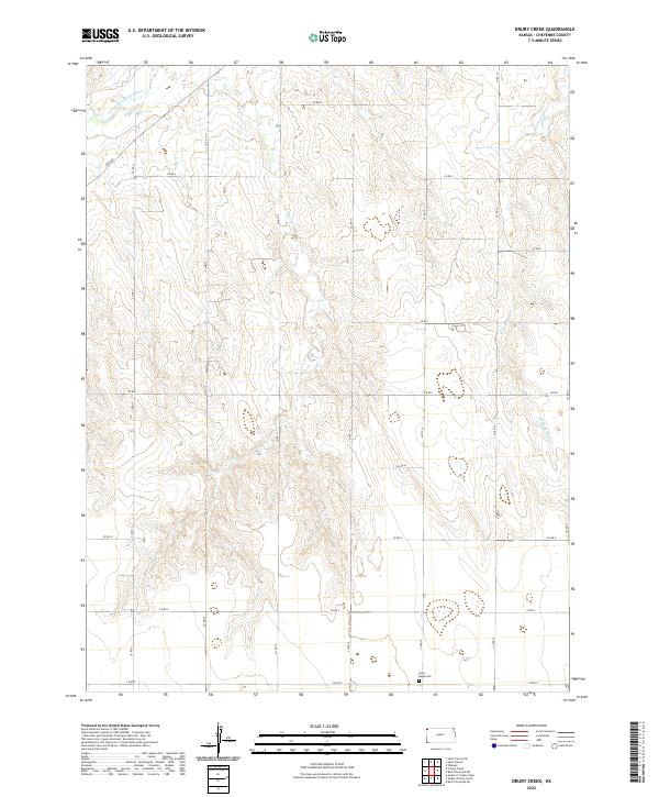
2022 Map of Drury Creek
USGS Topo · Published 2022About this map
Drury Cr meanders through the central draws of Cheyenne County, defining the drainage patterns of this High Plains landscape. The map reveals a strictly organized section-line grid of county roads, such as Co RD 13 and Co RD M, that carve the territory into square-mile parcels. In the northwest corner, the S Fork Republican River cuts a wider path across the terrain, accompanied by the aptly named River Rd. This 2022 survey provides critical spatial data for the rural township, documenting the persistent presence of Lawn Ridge Cem in the southeast. The geography is characterized by the upland divides between the W Fork Sand Cr and other local drainages, illustrating the vast, agricultural layout of western Kansas.
Find a feature on this map
27 named features on this map. Tap any name to fly to it.
Don’t see what you’re looking for? This feature index may not catch every label — zoom into the map to look around manually.
Map Details
Editions of this 2022 Drury Creek Map
This is the sole edition of this map. No revisions or reprints were ever made.
Other maps of this area

1942 · St. Francis
USGS Topo · 1:62,500

1943 · St. Francis
USGS Topo · 1:62,500

1951 · St Francis
USGS Topo · 1:62,500

1951 · Bird City North
USGS Topo · 1:62,500

1951 · Bird City South
USGS Topo · 1:62,500

1952 · St Francis 3
USGS Topo · 1:62,500

1954 · Goodland
USGS Topo · 1:250,000

1956 · Goodland
USGS Topo · 1:250,000

1957 · Goodland
USGS Topo · 1:250,000
1978 · St Francis
USGS Topo · 1:24,000