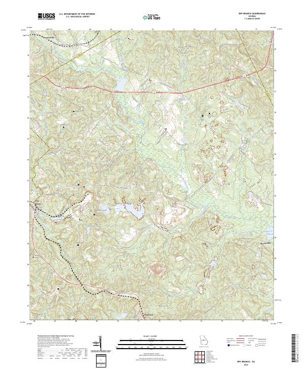
2024 Map of Dry Branch
USGS Topo · Published 2024About this map
Griswoldville and the surrounding pine-oak woodlands of Twiggs County define this landscape where the Fall Line Fwy intersects a network of local roads like Old Gordon Rd and Irwinton Rd. The terrain is deeply etched by the drainage of Big Sandy Creek and its many tributaries, including Little Sandy Creek and Hammocks Branch. This area is characterized by a high density of family and community burial sites, including Kitchens Cem #1, Epps - Champion Cem, and Tharp Cem, which provide significant points of interest for genealogical research. The southeastern portion of the map features Myricks Mill near Myricks Millpond, illustrating the historic reliance on water power along Wolf Creek and Game Creek in this part of Georgia.
Find a feature on this map
85 named features on this map. Tap any name to fly to it.
Don’t see what you’re looking for? This feature index may not catch every label — zoom into the map to look around manually.
Map Details
Editions of this 2024 Dry Branch Map
This is the sole edition of this map. No revisions or reprints were ever made.
Other maps of this area

1956 · Gordon
USGS Topo · 1:62,500

1956 · Warner Robins
USGS Topo · 1:62,500

1956 · Jeffersonville
USGS Topo · 1:62,500

1956 · Macon East
USGS Topo · 1:24,000

1956 · Macon
USGS Topo · 1:62,500

1957 · Macon
USGS Topo · 1:250,000

1958 · Macon
USGS Topo · 1:250,000

1964 · Macon
USGS Topo · 1:250,000
1973 · Gordon
USGS Topo · 1:24,000

1973 · Massey Hill
USGS Topo · 1:24,000