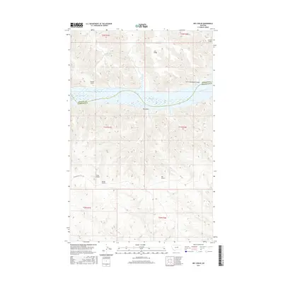
2017 Map of Dry Coulee
USGS Topo · Published 2017About this map
The Missouri River carves a winding path through this central Montana landscape, where the border between Phillips and Petroleum counties is defined by the river's channel. This 2017 survey shows the eastern reaches of Fort Peck Lake and the intricate drainage system of the surrounding breaks. Local history is etched into the terrain through features like the Old Musselshell Trl, an early transport route traversing the southern sections near Fisher Coulee.
Find a feature on this map
21 named features on this map. Tap any name to fly to it.
Don’t see what you’re looking for? This feature index may not catch every label — zoom into the map to look around manually.
Map Details
Editions of this 2017 Dry Coulee Map
This is the sole edition of this map. No revisions or reprints were ever made.
Other maps of this area

1954 · Lewistown
USGS Topo · 1:250,000

1959 · Lewistown
USGS Topo · 1:250,000

1965 · Karsten Coulee
USGS Topo · 1:24,000

1965 · Dry Coulee
USGS Topo · 1:24,000

1965 · Chain Buttes
USGS Topo · 1:24,000
1965 · Weingart Place
USGS Topo · 1:24,000

1965 · Lake Reservoir
USGS Topo · 1:24,000

1965 · Weingart Place NW
USGS Topo · 1:24,000

1971 · Blizzard Reservoir
USGS Topo · 1:24,000

1971 · Hanson Flat
USGS Topo · 1:24,000