
1965 Map of Weingart Place NW
USGS Topo · Published 1969About this map
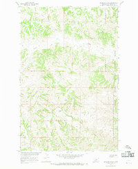
Crooked Creek meanders through this section of Petroleum County, carving a series of complex drainages across the Montana landscape as part of the Missouri River Basin development program. The topography is defined by the winding paths of Blacktail Coulee and Drag Creek, which illustrate the natural erosion patterns of the region's uplands. A notable human intervention in this drainage network is the Spillway located in the southeastern corner, signifying water management efforts in an area where the terrain dictated the placement of early ranching and land use boundaries. The map captures the transition between Township 19 North and Township 20 North, revealing the intricate land survey system that organized this portion of the western frontier.
Find a feature on this map
6 named features on this map. Tap any name to fly to it.
Don’t see what you’re looking for? This feature index may not catch every label — zoom into the map to look around manually.
Map Details
Editions of this 1965 Weingart Place NW Map
This is the sole edition of this map. No revisions or reprints were ever made.
Other maps of this area

1954 · Lewistown
USGS Topo · 1:250,000

1959 · Lewistown
USGS Topo · 1:250,000

1965 · Dry Coulee
USGS Topo · 1:24,000

1965 · Chain Buttes
USGS Topo · 1:24,000
1965 · Weingart Place
USGS Topo · 1:24,000

1971 · Hanson Flat
USGS Topo · 1:24,000

1984 · Zortman
USGS Topo · 1:100,000
1985 · Kirkendal Flat
USGS Topo · 1:24,000

1985 · Brown Spring
USGS Topo · 1:24,000
1985 · Dovetail Butte
USGS Topo · 1:24,000