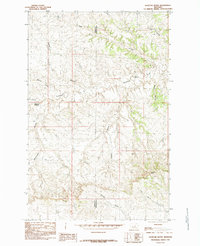
1985 Map of Dovetail Butte
USGS Topo · Published 1985About this map
The Sacagawea River winds through this arid Montana landscape on the border of Fergus and Petroleum Counties. This 1985 survey captures a terrain defined by an intricate network of erosional drainages, including Wolf Coulee and Whisker Coulee, which carve through the high plains toward the river valley. The topography is dominated by the prominent landmark of Dovetail Butte in the southeast and the strategic Chimney Crossing to the west. While no major towns are shown, the nomenclature of the landscape—with names like Rasmussen Coulee, Pickerd Coulee, and Connoly Coulee—suggests the deep influence of early ranching families and homesteaders on the local geography. The map provides a detailed look at the drainage patterns of the Missouri River basin before late-century changes in land use and ranching practices.
Find a feature on this map
12 named features on this map. Tap any name to fly to it.
Don’t see what you’re looking for? This feature index may not catch every label — zoom into the map to look around manually.
Map Details
Editions of this 1985 Dovetail Butte Map
This is the sole edition of this map. No revisions or reprints were ever made.
Other maps of this area

1954 · Lewistown
USGS Topo · 1:250,000

1959 · Lewistown
USGS Topo · 1:250,000

1965 · Dry Coulee
USGS Topo · 1:24,000

1965 · Weingart Place NW
USGS Topo · 1:24,000

1971 · Kepple Bottoms
USGS Topo · 1:24,000

1971 · Hanson Flat
USGS Topo · 1:24,000

1984 · Zortman
USGS Topo · 1:100,000

1985 · Brown Spring
USGS Topo · 1:24,000

1985 · Valentine
USGS Topo · 1:24,000
1985 · Pipes Coulee
USGS Topo · 1:24,000