1985 Map of Brown Spring
USGS Topo · Published 1985About this map
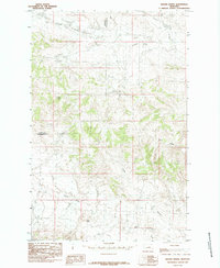
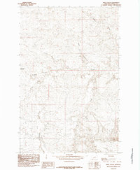
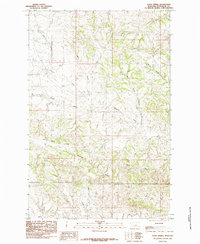
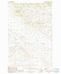
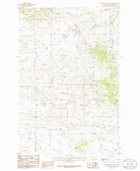
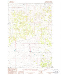
Brown Spring and the surrounding rangeland of central Montana are captured in this 1985 survey, showing the intricate drainages and topographic relief that characterize the region. The landscape is defined by the winding paths of Dovetail Creek to the north and Blood Creek to the south, which carve through the high plains. Significant geological and terrain features such as Dunn Ridge and the prominent Dog Butte provide verticality to an area otherwise marked by remote coulees and seasonal water sources.
Find a feature on this map
8 named features on this map. Tap any name to fly to it.
Don’t see what you’re looking for? This feature index may not catch every label — zoom into the map to look around manually.
Map Details
Editions of this 1985 Brown Spring Map
This is the sole edition of this map. No revisions or reprints were ever made.
Other maps of this area

1954 · Lewistown
USGS Topo · 1:250,000

1959 · Lewistown
USGS Topo · 1:250,000
1965 · Weingart Place NW
USGS Topo · 1:24,000
1985 · Dovetail Butte
USGS Topo · 1:24,000
1985 · Valentine
USGS Topo · 1:24,000
1985 · Pipes Coulee
USGS Topo · 1:24,000
1985 · Davis Spring
USGS Topo · 1:24,000
1986 · Dry Blood Creek West
USGS Topo · 1:24,000
1986 · Dry Blood Creek East
USGS Topo · 1:24,000
1986 · Cat Creek NW
USGS Topo · 1:24,000