
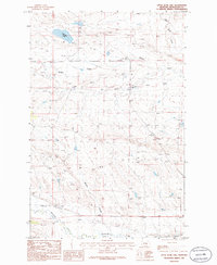
1986 Map of Dry Blood Creek West
USGS Topo · Published 1986About this map
Dry Blood Creek and its seasonal drainage network define the broken topography of this Petroleum County landscape as it appeared in the late 1970s and mid-1980s. The map illustrates a high-plains environment where water is the primary architect of the land, evidenced by the deeply incised paths of South Fork Dry Blood Creek and Box Elder Creek. The absence of named towns or major infrastructure highlights the expansive, open nature of this part of Montana, where land use was primarily centered on ranching and resource management. Historically-minded researchers can trace the natural corridors of Fords Creek, noting how the drainage patterns dictated the placement of unimproved roads and cattle trails across the plains. This provisional study serves as a clear record of the area's physical geography before modern digital mapping, preserving the specific watercourse names used by local residents and ranchers during this era.
Find a feature on this map
4 named features on this map. Tap any name to fly to it.
Don’t see what you’re looking for? This feature index may not catch every label — zoom into the map to look around manually.
Map Details
Editions of this 1986 Dry Blood Creek West Map
This is the sole edition of this map. No revisions or reprints were ever made.
Other maps of this area

1954 · Lewistown
USGS Topo · 1:250,000

1959 · Lewistown
USGS Topo · 1:250,000

1985 · Brown Spring
USGS Topo · 1:24,000

1985 · Bear Creek Reservoir SE
USGS Topo · 1:24,000

1985 · Valentine
USGS Topo · 1:24,000

1986 · Wild Horse Lake
USGS Topo · 1:24,000

1986 · Winnett North
USGS Topo · 1:24,000

1986 · Dry Blood Creek East
USGS Topo · 1:24,000

1986 · Teigen
USGS Topo · 1:24,000
1986 · Little Bear Lake
USGS Topo · 1:24,000