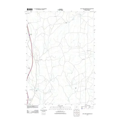
2012 Map of Dry Creek Reservoir
USGS Topo · Published 2012About this map
Working livestock operations and water management systems define this high plains landscape in Johnson County. Ranching history is deeply etched into the geography, represented by family-named holdings such as the Goyhenex Ranch, Ullery Ranch, and Williams Ranch. The inclusion of specific seasonal sites like the Taylor Brothers Sheep Camp and Lund Sheep Camp provides a detailed look at the specialized grazing patterns that have long sustained the regional economy.
Find a feature on this map
23 named features on this map. Tap any name to fly to it.
Don’t see what you’re looking for? This feature index may not catch every label — zoom into the map to look around manually.
Map Details
Editions of this 2012 Dry Creek Reservoir Map
This is the sole edition of this map. No revisions or reprints were ever made.
Other maps of this area

1955 · Arminto
USGS Topo · 1:250,000

1958 · Arminto
USGS Topo · 1:250,000

1961 · Kaycee NE
USGS Topo · 1:24,000

1961 · Fourmile Reservoir
USGS Topo · 1:24,000

1961 · Figure 8 Reservoir
USGS Topo · 1:24,000

1961 · Dry Creek Reservoir
USGS Topo · 1:24,000

1961 · Antelope Draw
USGS Topo · 1:24,000

1961 · Schlict Draw
USGS Topo · 1:24,000

1961 · Elaine Draw
USGS Topo · 1:24,000

1961 · Hibbard Draw
USGS Topo · 1:24,000