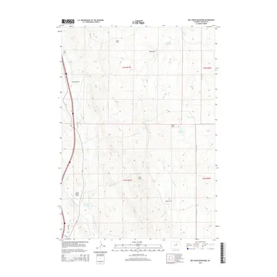
2015 Map of Dry Creek Reservoir
USGS Topo · Published 2015About this map
Chris LeDoux Point stands as a prominent landmark in this segment of Johnson County, overlooking a landscape defined by complex drainage systems and high ridges. The area is marked by the convergence of several major draws, including Antelope Draw, Frost Draw, and Bybee Draw, which channel seasonal water toward the N Fork Powder River in the south. This modern survey illustrates the critical role of water management in the arid Wyoming terrain, shown through the distribution of the Dry Cr Reservoir, Amerada Reservoir, and Taylor Number 1 Reservoir. The road network, featuring Reno Rd and Coal Mine Rd, follows the natural contours established by Pine Ridge, providing access to this primarily open-range territory where geography dictates the movement of both water and travelers.
Find a feature on this map
26 named features on this map. Tap any name to fly to it.
Don’t see what you’re looking for? This feature index may not catch every label — zoom into the map to look around manually.
Map Details
Editions of this 2015 Dry Creek Reservoir Map
This is the sole edition of this map. No revisions or reprints were ever made.
Other maps of this area

1955 · Arminto
USGS Topo · 1:250,000

1958 · Arminto
USGS Topo · 1:250,000

1961 · Kaycee NE
USGS Topo · 1:24,000

1961 · Fourmile Reservoir
USGS Topo · 1:24,000

1961 · Figure 8 Reservoir
USGS Topo · 1:24,000

1961 · Dry Creek Reservoir
USGS Topo · 1:24,000

1961 · Antelope Draw
USGS Topo · 1:24,000

1961 · Schlict Draw
USGS Topo · 1:24,000

1961 · Elaine Draw
USGS Topo · 1:24,000

1961 · Hibbard Draw
USGS Topo · 1:24,000