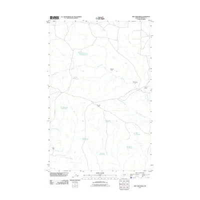
2011 Map of Dry Fork Ridge
USGS Topo · Published 2011About this map
Dry Fork Ridge defines the high ground in this section of Phillips County, where a complex network of seasonal drainages and man-made water catchments supports the high plains landscape. The drainage system is anchored by Dry Fork Creek and its major tributary, the West Fork Dry Fork Creek, which are supplemented by numerous small-scale water projects including Happy Gang Reservoir, Dusky Reservoir, and Wrangler Reservoir.
Find a feature on this map
18 named features on this map. Tap any name to fly to it.
Don’t see what you’re looking for? This feature index may not catch every label — zoom into the map to look around manually.
Map Details
Editions of this 2011 Dry Fork Ridge Map
This is the sole edition of this map. No revisions or reprints were ever made.
Other maps of this area

1954 · Lewistown
USGS Topo · 1:250,000

1959 · Lewistown
USGS Topo · 1:250,000

1965 · Karsten Coulee
USGS Topo · 1:24,000

1965 · Veseth Reservoir
USGS Topo · 1:24,000

1965 · Dry Fork Ridge
USGS Topo · 1:24,000
1965 · Holzhey Reservoir
USGS Topo · 1:24,000
1965 · Barber Coulee
USGS Topo · 1:24,000

1965 · Lake Reservoir
USGS Topo · 1:24,000

1971 · Bison Bone Reservoir
USGS Topo · 1:24,000
1971 · Coburn Butte
USGS Topo · 1:24,000