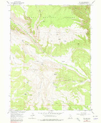
1966 Map of Dry Fork
USGS Topo · Published 1978About this map
The Ashley National Forest dominates this mid-century landscape in Uintah County, where the high-elevation ridges of Sawtooth Ridge and Pine Ridge give way to deep drainage basins. The settlement of Dry Fork sits along its namesake creek, serving as a hub for the scattered springs and water sources vital to this arid high-country terrain. A Cem near the fork and the prominent Old Military Reservation Boundary cutting across the southern half of the map provide clear evidence of early territorial land management and community life. Economic activity is etched into the earth through features like the Coal Mine Basin and various unnamed Mines in the south, while a Gaging Station on Dry Fork suggests the importance of water monitoring. The presence of the Red Cloud Loop and numerous Jeep Trails indicates the region's transition into a destination for recreation and resource management.
Find a feature on this map
43 named features on this map. Tap any name to fly to it.
Don’t see what you’re looking for? This feature index may not catch every label — zoom into the map to look around manually.
Map Details
Editions of this 1966 Dry Fork Map
2 editions found
Other maps of this area

1885 · Ashley
USGS Topo · 1:250,000

1906 · Marsh Peak
USGS Topo · 1:125,000

1908 · Marsh Peak
USGS Topo · 1:125,000

1917 · Vernal
USGS Topo · 1:125,000

1950 · Dyer Mountain
USGS Topo · 1:24,000

1954 · Vernal
USGS Topo · 1:250,000

1958 · Vernal
USGS Topo · 1:250,000

1960 · Vernal
USGS Topo · 1:250,000

1964 · Vernal NE
USGS Topo · 1:24,000

1964 · Lapoint
USGS Topo · 1:24,000