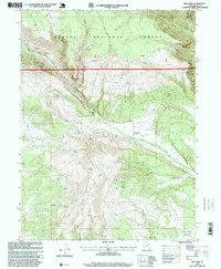
1996 Map of Dry Fork
USGS Topo · Published 1999About this map
Ashley National Forest dominates this landscape in northeastern Utah, where high-altitude ridges and deep canyons define the transition from the high plateau to the basin floor. The settlement at Dry Fork serves as a focal point for the region's agricultural and pastoral activity, situated near a local Cemetery and the winding course of the creek. The topography is intricately mapped with numerous natural springs, such as June Spring and Chivers Spring, which historically supported livestock and early homesteaders in this arid environment.
Find a feature on this map
48 named features on this map. Tap any name to fly to it.
Don’t see what you’re looking for? This feature index may not catch every label — zoom into the map to look around manually.
Map Details
Editions of this 1996 Dry Fork Map
This is the sole edition of this map. No revisions or reprints were ever made.
Other maps of this area

1885 · Ashley
USGS Topo · 1:250,000

1906 · Marsh Peak
USGS Topo · 1:125,000

1908 · Marsh Peak
USGS Topo · 1:125,000

1917 · Vernal
USGS Topo · 1:125,000

1950 · Dyer Mountain
USGS Topo · 1:24,000

1954 · Vernal
USGS Topo · 1:250,000

1958 · Vernal
USGS Topo · 1:250,000

1960 · Vernal
USGS Topo · 1:250,000

1964 · Vernal NE
USGS Topo · 1:24,000

1964 · Lapoint
USGS Topo · 1:24,000