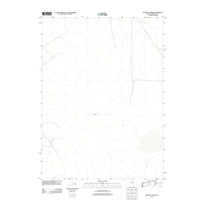
2011 Map of Dry Hills North
USGS Topo · Published 2011About this map
Dry Hills dominates the topography of this section of Humboldt County, Nevada, providing a stark view of the high desert landscape as it appeared in the early 21st century. The terrain is defined by the ephemeral drainages of Chimney Creek in the northeast and Rabbit Creek in the southeast, which carve subtle paths through the arid basins. Human imprint on this vast rangeland is sparse, centered primarily on transportation routes like Kelly Creek Rd. This survey captures the region just as digital mapping standards were becoming the norm, documenting the precise location of traditional watercourses and landforms that have long guided movement through this part of the Great Basin.
Find a feature on this map
4 named features on this map. Tap any name to fly to it.
Don’t see what you’re looking for? This feature index may not catch every label — zoom into the map to look around manually.
Map Details
Editions of this 2011 Dry Hills North Map
This is the sole edition of this map. No revisions or reprints were ever made.
Other maps of this area

1882 · Paradise
USGS Topo · 1:250,000

1893 · Paradise
USGS Topo · 1:250,000

1945 · Osgood Mountains
USGS Topo · 1:62,500

1945 · Hot Springs
USGS Topo · 1:62,500

1947 · Osgood Mountains
USGS Topo · 1:62,500

1947 · Hot Springs Peak
USGS Topo · 1:62,500

1955 · McDermitt
USGS Topo · 1:250,000

1959 · McDermitt
USGS Topo · 1:250,000
1980 · Layton Spring
USGS Topo · 1:24,000

1980 · Dry Hills South
USGS Topo · 1:24,000