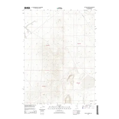
2015 Map of Dry Hills North
USGS Topo · Published 2015About this map
Clover Valley sits at the southern edge of this high-desert landscape in Humboldt County, where the terrain shifts toward the more complex elevations of the interior basin. The map tracks the passage of Kelly Creek Rd as it cuts through the north, providing a vital transport corridor across the sagebrush-covered flats. Intermittent water features, including the drainages of Chimney Cr and Rabbit Cr, underscore the arid character of the region. These ephemeral streams are essential markers of the local topography, shaping the drainages that flow from the surrounding highlands. The layout of Township and Range boundaries—notably t40n r43e and t39n r42e—reveals the systematic grid of public land management that continues to govern this portion of Nevada.
Find a feature on this map
8 named features on this map. Tap any name to fly to it.
Don’t see what you’re looking for? This feature index may not catch every label — zoom into the map to look around manually.
Map Details
Editions of this 2015 Dry Hills North Map
This is the sole edition of this map. No revisions or reprints were ever made.
Other maps of this area

1882 · Paradise
USGS Topo · 1:250,000

1893 · Paradise
USGS Topo · 1:250,000

1945 · Osgood Mountains
USGS Topo · 1:62,500

1945 · Hot Springs
USGS Topo · 1:62,500

1947 · Osgood Mountains
USGS Topo · 1:62,500

1947 · Hot Springs Peak
USGS Topo · 1:62,500

1955 · McDermitt
USGS Topo · 1:250,000

1959 · McDermitt
USGS Topo · 1:250,000
1980 · Layton Spring
USGS Topo · 1:24,000

1980 · Dry Hills South
USGS Topo · 1:24,000