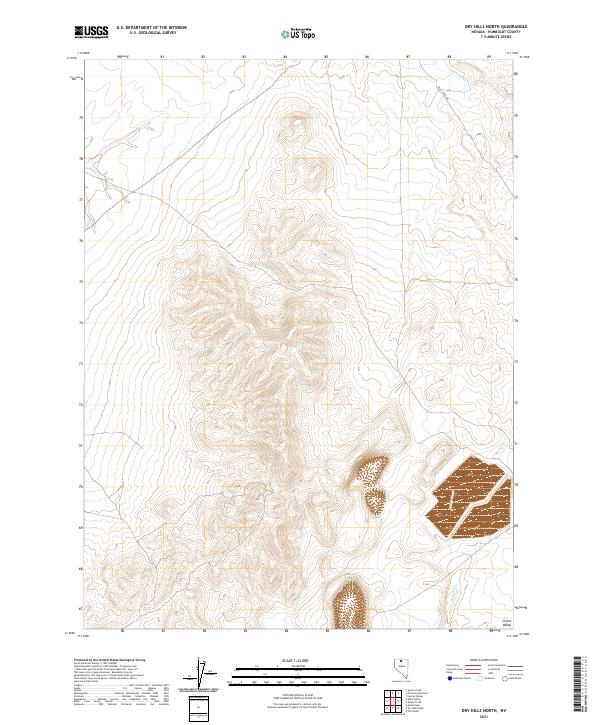
2021 Map of Dry Hills North
USGS Topo · Published 2021About this map
Clover Valley defines the southeastern corner of this landscape, where the terrain transitions into a broad alluvial plain at the edge of the mountains. The northern and central sections are dominated by the elevation gains of the Dry Hills, characterized by a complex network of ridgelines and ephemeral watercourses. Evidence of early infrastructure is visible along Kelly Creek Rd, which serves as a primary transit corridor through the northeastern portion of the quadrangle. Drainage patterns are established by Chimney Cr in the north and Rabbit Cr to the southeast, illustrating how seasonal water flow has historically shaped the topography of this part of Humboldt County. The map provides a clear look at the public land survey system, with township and range lines like t40n r43e and t39n r42e delineating the remote territory.
Find a feature on this map
8 named features on this map. Tap any name to fly to it.
Don’t see what you’re looking for? This feature index may not catch every label — zoom into the map to look around manually.
Map Details
Editions of this 2021 Dry Hills North Map
This is the sole edition of this map. No revisions or reprints were ever made.
Other maps of this area

1882 · Paradise
USGS Topo · 1:250,000

1893 · Paradise
USGS Topo · 1:250,000

1945 · Osgood Mountains
USGS Topo · 1:62,500

1945 · Hot Springs
USGS Topo · 1:62,500

1947 · Osgood Mountains
USGS Topo · 1:62,500

1947 · Hot Springs Peak
USGS Topo · 1:62,500

1955 · McDermitt
USGS Topo · 1:250,000

1959 · McDermitt
USGS Topo · 1:250,000
1980 · Layton Spring
USGS Topo · 1:24,000

1980 · Dry Hills South
USGS Topo · 1:24,000