
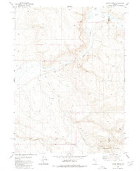
1980 Map of Dry Hills North
USGS Topo · Published 1980About this map
Dry Hills dominate the center of this Humboldt County landscape, rising between the pastoral stretches of Eden Valley and the drainage of Chimney Creek. This 1980 survey, based on aerial photography from the mid-1970s, documents a high-desert environment where water management and mineral exploration were central to the local geography. Evidence of human activity is sparse but specific, including a small Prospect located in the southern section of the hills and several remote water sources, such as a Well in the west and Rabbit Creek in the southeast corner. These features reflect the typical infrastructure of Nevada's interior ranges, where ranchers and prospectors relied on isolated springs and small-scale excavations while navigating the section lines of Township 39 and 40 North.
Find a feature on this map
7 named features on this map. Tap any name to fly to it.
Don’t see what you’re looking for? This feature index may not catch every label — zoom into the map to look around manually.
Map Details
Editions of this 1980 Dry Hills North Map
This is the sole edition of this map. No revisions or reprints were ever made.
Other maps of this area

1882 · Paradise
USGS Topo · 1:250,000

1893 · Paradise
USGS Topo · 1:250,000

1945 · Osgood Mountains
USGS Topo · 1:62,500

1945 · Hot Springs
USGS Topo · 1:62,500

1947 · Osgood Mountains
USGS Topo · 1:62,500

1947 · Hot Springs Peak
USGS Topo · 1:62,500

1955 · McDermitt
USGS Topo · 1:250,000

1959 · McDermitt
USGS Topo · 1:250,000
1980 · Layton Spring
USGS Topo · 1:24,000

1980 · Dry Hills South
USGS Topo · 1:24,000