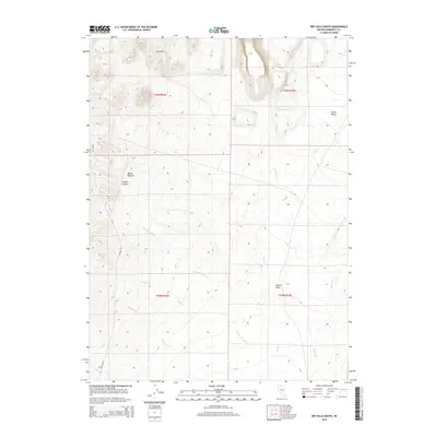
2015 Map of Dry Hills South
USGS Topo · Published 2015About this map
The Dry Hills and the southern reaches of Clover Valley define this landscape in Humboldt County. This 2015 survey reveals a complex drainage network where intermittent streams like Rabbit Cr and Kelly Cr descend from the heights toward the basin floor. The geography is marked by significant topographical shifts, from the elevations of Rocky Canyon and Hansen Canyon in the west to the open expanse of Layton Field in the southeast. Named watercourses such as Summer Camp Cr, Julian Cr, and Osgood Cr trace the natural paths of runoff across the terrain. While the area remains largely undeveloped, the presence of Pinson Rd and Getchel Rd provides evidence of the regional transportation network connecting these high-desert drainage basins.
Find a feature on this map
18 named features on this map. Tap any name to fly to it.
Don’t see what you’re looking for? This feature index may not catch every label — zoom into the map to look around manually.
Map Details
Editions of this 2015 Dry Hills South Map
This is the sole edition of this map. No revisions or reprints were ever made.
Other maps of this area

1882 · Paradise
USGS Topo · 1:250,000

1893 · Paradise
USGS Topo · 1:250,000

1945 · Osgood Mountains
USGS Topo · 1:62,500

1945 · Hot Springs
USGS Topo · 1:62,500

1947 · Osgood Mountains
USGS Topo · 1:62,500

1947 · Hot Springs Peak
USGS Topo · 1:62,500

1955 · McDermitt
USGS Topo · 1:250,000

1959 · McDermitt
USGS Topo · 1:250,000

1980 · Dry Hills South
USGS Topo · 1:24,000
1980 · The Knolls
USGS Topo · 1:24,000