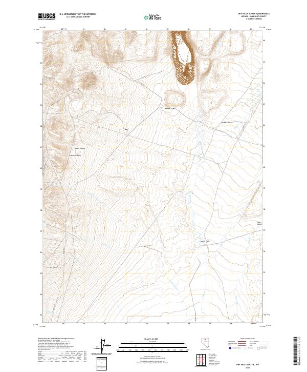
2021 Map of Dry Hills South
USGS Topo · Published 2021About this map
Layton Field and the expansive basin of Clover Valley define this modern topographic study of northern Nevada. The landscape is primarily shaped by the drainage patterns of several seasonal watercourses, most notably Kelly Cr and Summer Camp Cr, which wind through the township boundaries of T38N and T39N. The transition from the high relief of Rocky Canyon and Hansen Canyon in the northwest to the flatter meadows of the valley floor illustrates the typical Great Basin geography of Humboldt County.
Find a feature on this map
17 named features on this map. Tap any name to fly to it.
Don’t see what you’re looking for? This feature index may not catch every label — zoom into the map to look around manually.
Map Details
Editions of this 2021 Dry Hills South Map
This is the sole edition of this map. No revisions or reprints were ever made.
Other maps of this area

1882 · Paradise
USGS Topo · 1:250,000

1893 · Paradise
USGS Topo · 1:250,000

1945 · Osgood Mountains
USGS Topo · 1:62,500

1945 · Hot Springs
USGS Topo · 1:62,500

1947 · Osgood Mountains
USGS Topo · 1:62,500

1947 · Hot Springs Peak
USGS Topo · 1:62,500

1955 · McDermitt
USGS Topo · 1:250,000

1959 · McDermitt
USGS Topo · 1:250,000

1980 · Dry Hills South
USGS Topo · 1:24,000
1980 · The Knolls
USGS Topo · 1:24,000