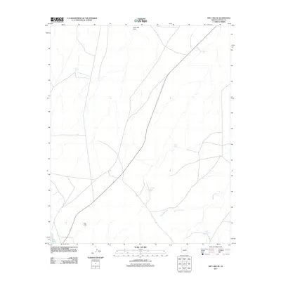
2011 Map of Dry Lake NE
USGS Topo · Published 2011About this map
Pink Cliffs stand as a primary geological landmark in this Navajo County landscape, where the arid terrain is defined by a complex network of seasonal water drainage and catchment. The map reveals an extensive system of man-made water improvements including West Nine Section Tank, South Nine Section Tank, and West Adamana Tank, illustrating the critical role of water management for ranching or land use in this part of Arizona. Large-scale drainage is channeled through Washboard Wash and Porter Tank Draw, which dominate the local hydrology. A small portion of Dry Lake is visible in the southwestern corner, anchoring a map that is otherwise characterized by isolated features such as Jeffers Tank and White Tank, connected by a sparse network of modern roads and trails.
Find a feature on this map
10 named features on this map. Tap any name to fly to it.
Don’t see what you’re looking for? This feature index may not catch every label — zoom into the map to look around manually.
Map Details
Editions of this 2011 Dry Lake NE Map
This is the sole edition of this map. No revisions or reprints were ever made.
Other maps of this area

1886 · Holbrook
USGS Topo · 1:250,000

1893 · Holbrook
USGS Topo · 1:250,000

1954 · Holbrook
USGS Topo · 1:250,000

1955 · St. Joseph 2 SE
USGS Topo · 1:24,000

1955 · Joseph City
USGS Topo · 1:62,500
1955 · Holbrook
USGS Topo · 1:62,500

1957 · Holbrook
USGS Topo · 1:250,000

1958 · Holbrook
USGS Topo · 1:250,000

1960 · Holbrook
USGS Topo · 1:250,000
1970 · Second Knolls
USGS Topo · 1:24,000