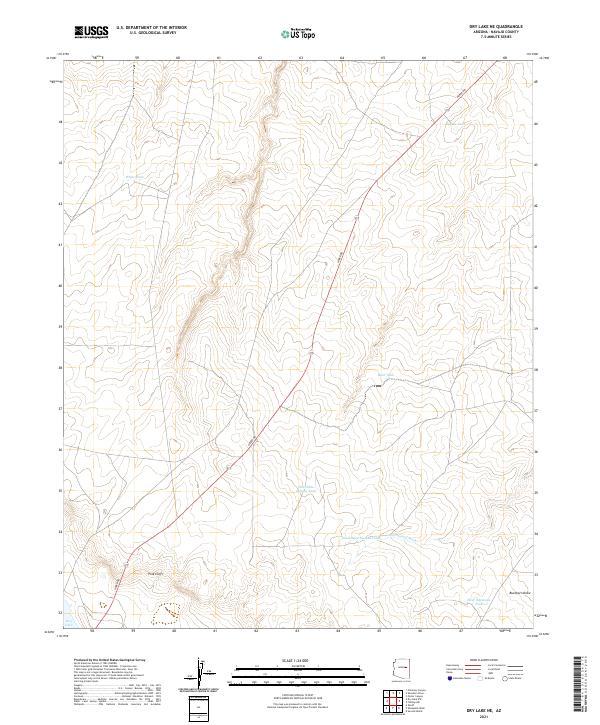
2021 Map of Dry Lake NE
USGS Topo · Published 2021About this map
The Pink Cliffs stand as a prominent landform in this high-desert landscape within the Navajo region. This 2021 study shows a terrain defined by water management and drainage, where the long stretch of Heber Rd cuts diagonally across township lines to connect isolated water sources. Named tanks such as White Tank, Jeffers Tank, and the West Nine Section Tank reveal the vital infrastructure required for ranching or land management in this arid environment. To the south, the terrain descends toward Dry Lake and the drainage of Washboard Wash, which is joined by Buckhorn Draw in the southeastern corner. The map provides a clear picture of the Public Land Survey System grid, illustrating how early surveying divisions continue to organize this open Arizona territory.
Find a feature on this map
16 named features on this map. Tap any name to fly to it.
Don’t see what you’re looking for? This feature index may not catch every label — zoom into the map to look around manually.
Map Details
Editions of this 2021 Dry Lake NE Map
This is the sole edition of this map. No revisions or reprints were ever made.
Other maps of this area

1886 · Holbrook
USGS Topo · 1:250,000

1893 · Holbrook
USGS Topo · 1:250,000

1954 · Holbrook
USGS Topo · 1:250,000

1955 · St. Joseph 2 SE
USGS Topo · 1:24,000

1955 · Joseph City
USGS Topo · 1:62,500
1955 · Holbrook
USGS Topo · 1:62,500

1957 · Holbrook
USGS Topo · 1:250,000

1958 · Holbrook
USGS Topo · 1:250,000

1960 · Holbrook
USGS Topo · 1:250,000
1970 · Second Knolls
USGS Topo · 1:24,000