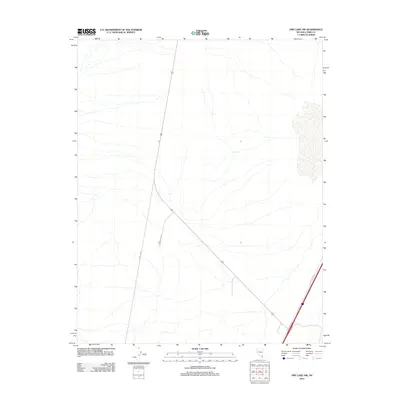
2012 Map of Dry Lake NW
USGS Topo · Published 2012About this map
Infrastructure development and transport corridors define this arid landscape in northeastern Clark County. The region is bisected by U.S. Route 93, a major highway artery that connects the area toward regional hubs. Branching off this primary route, industrial and utility access is provided by Apex Power Pkwy and the long, straight stretch of Power Line Rd. Along the southeastern edge of the sheet, Las Vegas Blvd N serves as a parallel corridor. The map reveals a high-desert environment where modern utility expansion and road networks have been laid out across the natural drainage patterns of the dry basin.
Find a feature on this map
4 named features on this map. Tap any name to fly to it.
Don’t see what you’re looking for? This feature index may not catch every label — zoom into the map to look around manually.
Map Details
Editions of this 2012 Dry Lake NW Map
This is the sole edition of this map. No revisions or reprints were ever made.
Other maps of this area

1886 · Saint Thomas
USGS Topo · 1:250,000

1893 · Saint Thomas
USGS Topo · 1:250,000

1907 · Las Vegas
USGS Topo · 1:250,000

1908 · Las Vegas
USGS Topo · 1:250,000

1926 · Boulder Canyon
USGS Topo · 1:96,000

1945 · Sheep Range
USGS Topo · 1:125,000

1952 · Gass Peak
USGS Topo · 1:62,500

1952 · Dry Lake
USGS Topo · 1:62,500

1954 · Las Vegas
USGS Topo · 1:250,000

1957 · Las Vegas
USGS Topo · 1:250,000