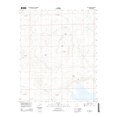
2014 Map of Dry Lake NW
USGS Topo · Published 2014About this map
Dry Lake anchors the southern boundary of this high-plateau landscape, where the drainage systems and livestock infrastructure of Navajo County are clearly defined. The terrain is shaped by a series of north-to-south drainages including Porter Tank Draw and Willow Patch Draw, which lead toward the distinct geologic formation of the Pink Cliffs. This 2014 survey documents the continued reliance on scattered water catchments such as Chamise Tank, Big Oil Well Tank, and Small Oil Well Tank, illustrating the essential resource management required in this arid region.
Find a feature on this map
24 named features on this map. Tap any name to fly to it.
Don’t see what you’re looking for? This feature index may not catch every label — zoom into the map to look around manually.
Map Details
Editions of this 2014 Dry Lake NW Map
This is the sole edition of this map. No revisions or reprints were ever made.
Other maps of this area

1886 · Holbrook
USGS Topo · 1:250,000

1893 · Holbrook
USGS Topo · 1:250,000

1954 · Holbrook
USGS Topo · 1:250,000

1955 · St. Joseph 2 SE
USGS Topo · 1:24,000

1955 · Joseph City
USGS Topo · 1:62,500

1957 · Holbrook
USGS Topo · 1:250,000

1958 · Holbrook
USGS Topo · 1:250,000

1960 · Holbrook
USGS Topo · 1:250,000

1970 · Red Knoll
USGS Topo · 1:24,000
1970 · McCauley Sinks
USGS Topo · 1:24,000