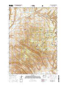
2014 Map of Dry Mountain
USGS Topo · Published 2014About this map
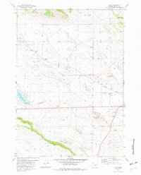
Dry Mountain dominates this high-elevation landscape within the southern reaches of the Ochoco National Forest. The topography is defined by a series of drainages, most notably Silver Cr, Wickiup Cr, and Egypt Cr, which carve through the volcanic plateau. A few man-made alterations to the landscape appear, such as the Dry Mountain Reservoir and a network of forest access routes including McCanlies Rd and Egypt Creek Rd. The southeastern corner of the map reveals the descent into Dick Miller Canyon, accessed by the namesake Dick Miller Rd. This 2014 survey serves as a precise record of public lands and forest management boundaries in Harney County, documenting the specific placement of the Beaver Slide and the lookout access infrastructure surrounding the mountain's peak.
Find a feature on this map
16 named features on this map. Tap any name to fly to it.
Don’t see what you’re looking for? This feature index may not catch every label — zoom into the map to look around manually.
Map Details
Editions of this 2014 Dry Mountain Map
This is the sole edition of this map. No revisions or reprints were ever made.
Other maps of this area

1955 · Burns
USGS Topo · 1:250,000

1958 · Burns
USGS Topo · 1:250,000

1959 · Burns
USGS Topo · 1:250,000

1959 · Sawtooth Creek
USGS Topo · 1:62,500

1961 · Delintment Lake
USGS Topo · 1:62,500
1981 · Egypt Canyon
USGS Topo · 1:24,000
1981 · Oakerman Lakes
USGS Topo · 1:24,000

1981 · Camp Currey Spring
USGS Topo · 1:24,000
1981 · Suntex
USGS Topo · 1:24,000
1981 · Riley
USGS Topo · 1:24,000