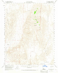
1957 Map of Dry Mountain
USGS Topo · Published 1967About this map
Death Valley National Monument encompasses the eastern half of this 1950s survey, where the dramatic elevation changes between the Panamint Range and the Saline Valley (Depression) are meticulously recorded. The terrain is punctuated by significant survey markers like Dry Mountain and Black Top, while the lower elevations reveal scarce water sources such as Marble Bath and Upper Warm Spr.
Find a feature on this map
14 named features on this map. Tap any name to fly to it.
Don’t see what you’re looking for? This feature index may not catch every label — zoom into the map to look around manually.
Map Details
Editions of this 1957 Dry Mountain Map
3 editions found
Other maps of this area

1908 · Lida
USGS Topo · 1:250,000

1908 · Ballarat
USGS Topo · 1:250,000

1913 · Lida
USGS Topo · 1:250,000

1913 · Ballarat
USGS Topo · 1:250,000

1948 · Death Valley
USGS Topo · 1:250,000

1950 · New York Butte
USGS Topo · 1:62,500

1950 · Ubehebe Peak
USGS Topo · 1:62,500

1951 · New York Butte
USGS Topo · 1:62,500

1951 · Ubehebe Peak
USGS Topo · 1:62,500

1951 · Marble Canyon
USGS Topo · 1:62,500