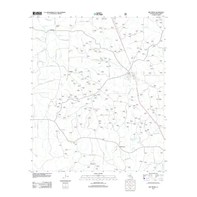
2012 Map of Dry Prong
USGS Topo · Published 2012About this map
Dry Prong serves as the central hub for this portion of Grant Parish, characterized by a complex network of forest roads and small creeks. The settlement pattern here is defined by crossroads communities like Fairfield and Oak Grove, which are connected by routes such as Fairfield Rd and Newton Rd. A notable point of navigation in the landscape is the Colfax Lookout Tower, positioned among the dense drainage basins of Cypress Cr and Beaver Cr. Local history is preserved in small burial grounds such as Midway Cem near Glady Hollow and Parsonage Cem to the south. The terrain is deeply etched by numerous small watercourses, including Three Branches Cr and Big Cr, illustrating the hydrological character of the Kisatchie National Forest region before more modern development altered these traditional boundaries.
Find a feature on this map
84 named features on this map. Tap any name to fly to it.
Don’t see what you’re looking for? This feature index may not catch every label — zoom into the map to look around manually.
Map Details
Editions of this 2012 Dry Prong Map
This is the sole edition of this map. No revisions or reprints were ever made.
Other maps of this area

1932 · Colfax NE
USGS Topo · 1:31,680

1932 · Boyce NE
USGS Topo · 1:31,680

1932 · Colfax SW
USGS Topo · 1:31,680

1932 · Colfax SE
USGS Topo · 1:31,680

1932 · Colfax NW
USGS Topo · 1:31,680

1936 · Colfax
USGS Topo · 1:62,500

1936 · Pollock
USGS Topo · 1:62,500

1941 · Alexandria
USGS Topo · 1:62,500

1941 · Pollock
USGS Topo · 1:62,500

1941 · Boyce
USGS Topo · 1:62,500