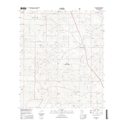
2015 Map of Dry Prong
USGS Topo · Published 2015About this map
Dry Prong serves as a central hub within the pine-heavy landscape of Grant Parish, positioned where the southern reaches of the Kisatchie National Forest meet agricultural and timber lands. The area is defined by a dense network of watercourses including Cypress Creek, Big Creek, and Chandler Creek, which drain toward the southwestern edge of the quadrangle near Lake Iatt. Smaller rural settlements like Fairfield, Faircloth, and Oak Grove are linked by a complex system of local roads and loops, such as Nelms Loop and Mundy Loop, reflecting the region's dispersed residential pattern.
Find a feature on this map
71 named features on this map. Tap any name to fly to it.
Don’t see what you’re looking for? This feature index may not catch every label — zoom into the map to look around manually.
Map Details
Editions of this 2015 Dry Prong Map
This is the sole edition of this map. No revisions or reprints were ever made.
Other maps of this area

1932 · Colfax NE
USGS Topo · 1:31,680

1932 · Boyce NE
USGS Topo · 1:31,680

1932 · Colfax SW
USGS Topo · 1:31,680

1932 · Colfax SE
USGS Topo · 1:31,680

1932 · Colfax NW
USGS Topo · 1:31,680

1936 · Colfax
USGS Topo · 1:62,500

1936 · Pollock
USGS Topo · 1:62,500

1941 · Alexandria
USGS Topo · 1:62,500

1941 · Pollock
USGS Topo · 1:62,500

1941 · Boyce
USGS Topo · 1:62,500