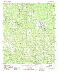
1985 Map of Dry Prong
USGS Topo · Published 1985About this map
Dry Prong serves as the central hub of this Grant Parish landscape, situated amidst the expansive woodland of the Kisatchie National Forest. Compiled from 1980 aerial photography, the map reveals a network of small settlements such as Fairfield, Faircloth, and Oak Grove connected by narrow roads through the timber. The terrain is defined by a dense drainage pattern including Black Creek, Dry Prong Creek, and Cypress Creek, which have shaped the local geography and dictated the placement of early homes and small community centers.
Find a feature on this map
28 named features on this map. Tap any name to fly to it.
Don’t see what you’re looking for? This feature index may not catch every label — zoom into the map to look around manually.
Map Details
Editions of this 1985 Dry Prong Map
This is the sole edition of this map. No revisions or reprints were ever made.
Other maps of this area

1932 · Colfax NE
USGS Topo · 1:31,680

1932 · Boyce NE
USGS Topo · 1:31,680

1932 · Colfax SW
USGS Topo · 1:31,680

1932 · Colfax SE
USGS Topo · 1:31,680

1932 · Colfax NW
USGS Topo · 1:31,680

1936 · Colfax
USGS Topo · 1:62,500

1936 · Pollock
USGS Topo · 1:62,500

1941 · Alexandria
USGS Topo · 1:62,500

1941 · Pollock
USGS Topo · 1:62,500

1941 · Boyce
USGS Topo · 1:62,500