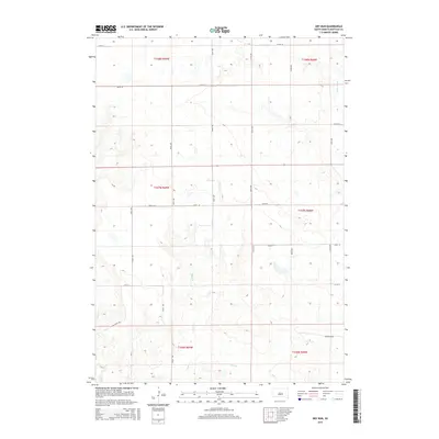
2015 Map of Dry Run
USGS Topo · Published 2015About this map
Dry Run snakes through the center of this Buffalo County landscape, defining a drainage system that feeds into the nearby Crow Cr. and Elm Cr.. The area is marked by the systematic grid of the Public Land Survey System, including t107n r69w and t108n r68w, which has shaped the rural road network of 356th Ave and 229th St. In the southeastern portion of the quadrangle, the terrain drops into Coyote Holw, a localized depression that breaks the steady rhythm of the surrounding plains. This 2015 survey reflects a classic South Dakota agricultural layout, where habitation and land use are closely tied to the section lines and the intermittent watercourses that traverse the prairie.
Find a feature on this map
23 named features on this map. Tap any name to fly to it.
Don’t see what you’re looking for? This feature index may not catch every label — zoom into the map to look around manually.
Map Details
Editions of this 2015 Dry Run Map
This is the sole edition of this map. No revisions or reprints were ever made.
Other maps of this area

1941 · Pukwana
USGS Topo · 1:62,500

1941 · Kimball North
USGS Topo · 1:62,500

1951 · Pukwana
USGS Topo · 1:62,500

1951 · Kimball North
USGS Topo · 1:62,500

1953 · Huron
USGS Topo · 1:250,000

1954 · Huron
USGS Topo · 1:250,000

1955 · Mitchell
USGS Topo · 1:250,000

1959 · Mitchell
USGS Topo · 1:250,000

1973 · Big Bend Dam 4 SE
USGS Topo · 1:24,000

1973 · Gannvalley
USGS Topo · 1:24,000
Featured Places
- Eden Township, SD
- Grant West Township, Crow Creek District
- Elvira Township, SD
- Eldorado Township, SD
- Pershing Township, SD