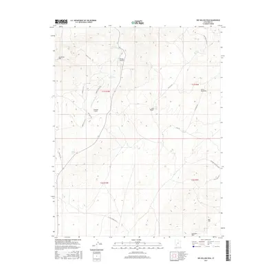
2017 Map of Dry Willow Peak
USGS Topo · Published 2017About this map
Dry Willow Peak anchors this high-elevation corner of the Black Mountains, where the landscape is defined by a network of drainage washes and small livestock or catchwater ponds. The terrain descends through prominent geological features like Parowan Canyon and Penney Hollow, revealing the complex topography of the eastern Escalante Valley transition. A series of specialized rural roads and cutoffs, including the Jackrabbit Seeding Cutoff and W Long Hollow Cutoff, suggests a landscape managed for range and watershed conservation. Small water bodies like Tebbs Pond, Coyote Pond, and Burnt Spot Pond are scattered across the high draws, providing critical points of reference in an otherwise open, arid environment. The map also captures the northern edge of the Red Hills, marking a shift in the southern geological character of the quadrangle.
Find a feature on this map
27 named features on this map. Tap any name to fly to it.
Don’t see what you’re looking for? This feature index may not catch every label — zoom into the map to look around manually.
Map Details
Editions of this 2017 Dry Willow Peak Map
This is the sole edition of this map. No revisions or reprints were ever made.
Other maps of this area

1885 · St. George
USGS Topo · 1:250,000

1885 · Beaver
USGS Topo · 1:250,000

1886 · Kanab
USGS Topo · 1:250,000

1891 · St. George
USGS Topo · 1:250,000

1950 · Enoch
USGS Topo · 1:62,500

1950 · Enoch NE
USGS Topo · 1:24,000

1952 · Enoch NE
USGS Topo · 1:24,000

1953 · Ninemile Knoll
USGS Topo · 1:24,000

1953 · Minersville
USGS Topo · 1:24,000

1953 · Richfield
USGS Topo · 1:250,000