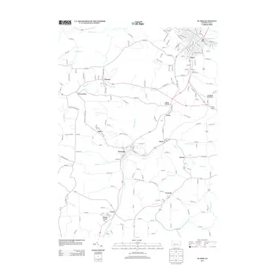
2013 Map of Du Bois
USGS Topo · Published 2013About this map
Du Bois and its surrounding borough-and-creek landscape define this area of Clearfield and Jefferson counties as it appeared in the early 21st century. The map centers on the transition from the concentrated grid of Du Bois and Sandy down to smaller coal-era settlements like Helvetia and Stump Creek. A dense network of drainage systems, including Sandy Lick Cr and Stump Cr, carves through the terrain, historically influencing the placement of the various rail junctions and mining communities. The connectivity between Sykesville, Troutville, and Rathmel is visible through a complex web of local routes and state highways. This survey illustrates the enduring residential footprint of these towns, many of which grew around the timber and coal industries of the previous century. Researchers can trace the path of the Soldier Run and Beaver Run corridors, which shaped the development of villages like Soldier and Eriton.
Find a feature on this map
182 named features on this map. Tap any name to fly to it.
Don’t see what you’re looking for? This feature index may not catch every label — zoom into the map to look around manually.
Map Details
Editions of this 2013 Du Bois Map
This is the sole edition of this map. No revisions or reprints were ever made.
Other maps of this area

1903 · Curwensville
USGS Topo · 1:62,500

1906 · Punxsutawney
USGS Topo · 1:62,500

1922 · Du Bois
USGS Topo · 1:62,500

1924 · Du Bois
USGS Topo · 1:62,500

1929 · Penfield
USGS Topo · 1:62,500

1932 · Penfield
USGS Topo · 1:62,500

1939 · Curwensville
USGS Topo · 1:62,500

1939 · Punxsutawney
USGS Topo · 1:62,500

1942 · Curwensville
USGS Topo · 1:62,500

1942 · Punxsutawney
USGS Topo · 1:62,500