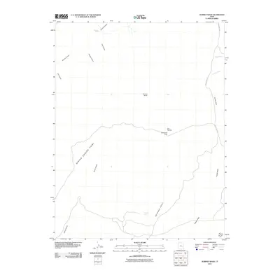
2010 Map of Dubinky Wash
USGS Topo · Published 2010About this map
Dripping Spring and Deadman Spring mark rare water sources in this arid stretch of Grand County, where the plateau landscape is deeply incised by a network of drainage systems. The topography is defined by significant landmarks such as Spring Canyon Point and Deadman Point, which overlook the complex branching of Spring Canyon and Cow Canyon. To the north and east, the seasonal drainages of Tenmile Wash and Dubinky Wash carve through the earth, passing prominent geological formations like Tenmile Butte and the distinctive Tombstone Butte.
Find a feature on this map
17 named features on this map. Tap any name to fly to it.
Don’t see what you’re looking for? This feature index may not catch every label — zoom into the map to look around manually.
Map Details
Editions of this 2010 Dubinky Wash Map
This is the sole edition of this map. No revisions or reprints were ever made.
Other maps of this area

1885 · San Rafael
USGS Topo · 1:250,000

1885 · La Sal
USGS Topo · 1:250,000

1951 · The Knoll
USGS Topo · 1:62,500

1952 · Tidwell 4 SE
USGS Topo · 1:24,000

1952 · Moab 3 NE
USGS Topo · 1:24,000

1952 · Moab 3 SE
USGS Topo · 1:24,000

1952 · Tidwell 4 NE
USGS Topo · 1:24,000

1952 · Moab 3 SW
USGS Topo · 1:24,000

1952 · Moab 3 NW
USGS Topo · 1:24,000

1954 · Tidwell 1 SE
USGS Topo · 1:24,000