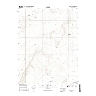
2014 Map of Dubinky Wash
USGS Topo · Published 2014About this map
Dubinky Wash and the complex drainage systems of Grand County define this high-desert landscape as it was documented in the early 21st century. The map reveals a labyrinth of canyons, including Tenmile Canyon, Cow Canyon, and Freckles Canyon, which provide critical pathways through a terrain dominated by dramatic vertical relief. Prominent landmarks such as Tombstone Butte, Tenmile Butte, and The Needles rise above the canyon floors, serving as vital orientation points for navigation in a region where water sources like Dripping Spring and Deadman Spring are scarce.
Find a feature on this map
25 named features on this map. Tap any name to fly to it.
Don’t see what you’re looking for? This feature index may not catch every label — zoom into the map to look around manually.
Map Details
Editions of this 2014 Dubinky Wash Map
This is the sole edition of this map. No revisions or reprints were ever made.
Other maps of this area

1885 · San Rafael
USGS Topo · 1:250,000

1885 · La Sal
USGS Topo · 1:250,000

1951 · The Knoll
USGS Topo · 1:62,500

1952 · Tidwell 4 SE
USGS Topo · 1:24,000

1952 · Moab 3 NE
USGS Topo · 1:24,000

1952 · Moab 3 SE
USGS Topo · 1:24,000

1952 · Tidwell 4 NE
USGS Topo · 1:24,000

1952 · Moab 3 SW
USGS Topo · 1:24,000

1952 · Moab 3 NW
USGS Topo · 1:24,000

1954 · Tidwell 1 SE
USGS Topo · 1:24,000