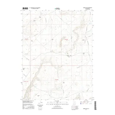
2017 Map of Dubinky Wash
USGS Topo · Published 2017About this map
Tenmile Butte and Tombstone Butte anchor a landscape defined by significant erosional features and ancient drainage systems in Grand County. The map details an intricate network of desert washes, most notably Tenmile Wash and Dubinky Wash, which transition into deep canyon systems such as Freckles Canyon and Trail Canyon. The region's limited water sources are marked by several isolated springs, including Dripping Spring, Deadman Spring, and Little Mountain Spring, which would have been critical landmarks for early travelers and cattlemen. Transport through this complex terrain follows established routes like Dubinky Well Rd and the path from Moab to Boulder Town. The topography is dominated by prominent overlooks and geological formations, including The Needles and Spring Canyon Point, reflecting the characteristic geology of the Colorado Plateau.
Find a feature on this map
32 named features on this map. Tap any name to fly to it.
Don’t see what you’re looking for? This feature index may not catch every label — zoom into the map to look around manually.
Map Details
Editions of this 2017 Dubinky Wash Map
This is the sole edition of this map. No revisions or reprints were ever made.
Other maps of this area

1885 · San Rafael
USGS Topo · 1:250,000

1885 · La Sal
USGS Topo · 1:250,000

1951 · The Knoll
USGS Topo · 1:62,500

1952 · Tidwell 4 SE
USGS Topo · 1:24,000

1952 · Moab 3 NE
USGS Topo · 1:24,000

1952 · Moab 3 SE
USGS Topo · 1:24,000

1952 · Tidwell 4 NE
USGS Topo · 1:24,000

1952 · Moab 3 SW
USGS Topo · 1:24,000

1952 · Moab 3 NW
USGS Topo · 1:24,000

1954 · Tidwell 1 SE
USGS Topo · 1:24,000